The devastating wildfires that strike Greece and the Mediterranean every summer have dramatically accelerated the development of early detection and monitoring technologies. In 2026, an ecosystem of satellites, drones, ground sensors, and artificial intelligence promises to transform how we fight wildfires, with Greece at the center of several innovative pilot programs.
📖 Read more: Smart City: Flood Detection Sensors
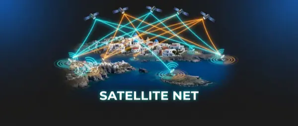
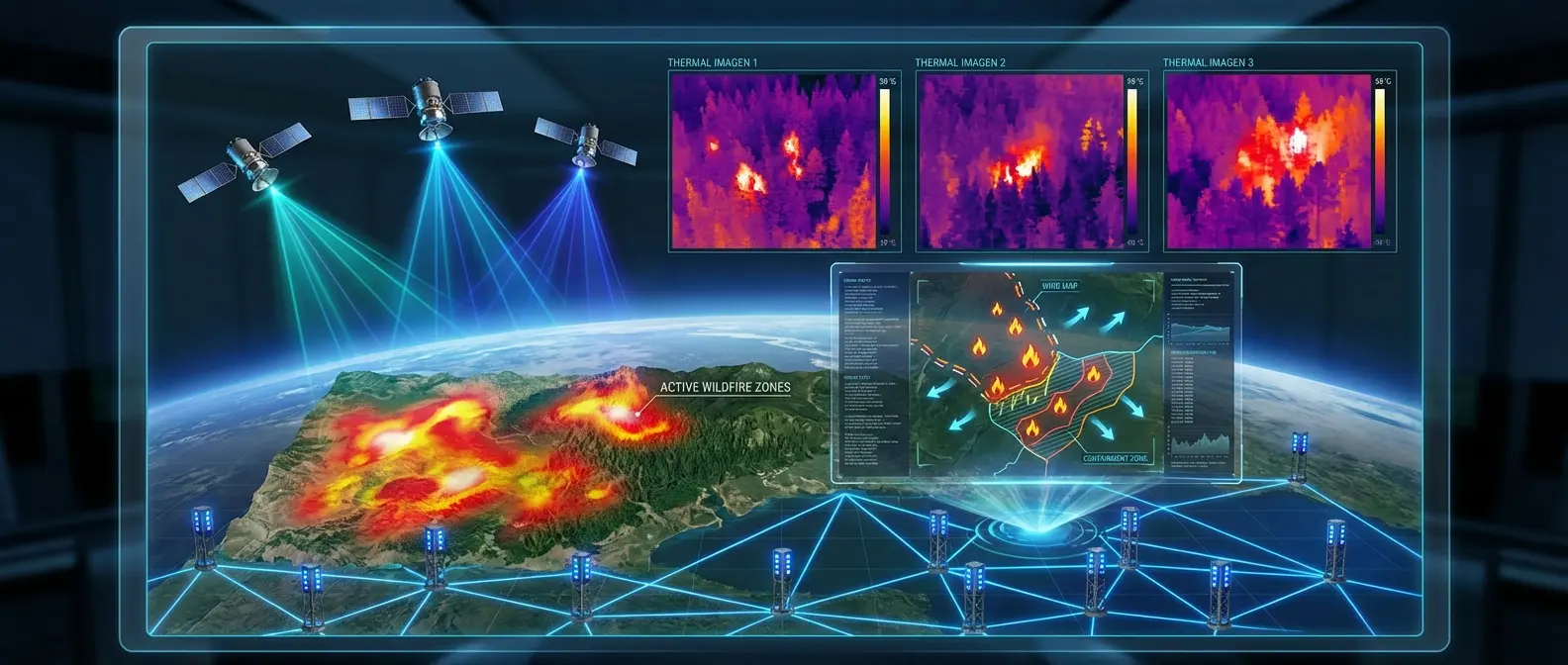
🚀 Next-Generation Satellite Monitoring
Space technology has made enormous leaps in wildfire detection. The new ESA (European Space Agency) satellites placed into orbit in 2025 offer spatial resolution down to 10 meters and a revisit time of every 15 minutes for the Mediterranean. This means a fire hotspot can be identified at an early stage, before it spreads uncontrollably. The Copernicus Emergency Management Service (CEMS) uses this data to produce real-time risk maps.
NASA, in collaboration with European agencies, has developed the FIRMS (Fire Information for Resource Management System) which now provides updates every 12 minutes for the wider Mediterranean region. The system uses data from the VIIRS and MODIS satellites, as well as the new Landsat-10 and Sentinel-3C. The most significant innovation is the ability to detect thermal anomalies even through smoke or clouds, using infrared and microwave imaging.
📡 Ground Sensors and IoT Networks
Alongside satellite monitoring, ground sensor networks form the second line of defense. In Greece, the "Fire Stations 2.0″ program of the Ministry of Climate Crisis and Civil Protection has already installed over 500 smart sensors in high-risk forest areas. These sensors measure temperature, humidity, wind speed, and airborne particle concentration, detecting even the smoke from a small fire hotspot.
LoRaWAN (Long Range Wide Area Network) technology allows these sensors to operate on batteries lasting up to 5 years, while transmitting data over distances of up to 15 kilometers. The data is collected at regional control centers and analyzed in real time by artificial intelligence algorithms trained to recognize patterns that precede the outbreak of a fire.
- PTZ Thermal Cameras Panoramic scanning cameras with thermal imaging, positioned at high points (towers, cell antennas). They cover a radius of up to 20 km and can detect temperature anomalies with 0.5°C accuracy.
- LIDAR Smoke Sensors Laser technology that detects airborne smoke particles from kilometers away. Particularly useful in areas with dense vegetation where visual monitoring is difficult.
- AI Weather Stations Stations that combine meteorological data with artificial intelligence to predict fire spread based on wind, humidity, and topography.
- Underground Moisture Sensors They measure soil and vegetation moisture, providing data on the drought index and ignition probability for each area.

📷 Drones and Aerial Surveillance
Unmanned aerial vehicles (UAV/drones) have become an integral part of wildfire response strategy. The Fire Service now has a fleet of 45 long-endurance drones (up to 8 hours of flight time) equipped with thermal cameras and multispectral sensors. These drones can operate autonomously on pre-set patrol routes or be directed to points of interest identified by satellites or ground sensors.
A particularly innovative application is the “drone swarms” being developed by the National Technical University of Athens in collaboration with the Institute of Informatics at NCSR “Demokritos”. Groups of 5–10 small drones coordinate autonomously to cover large areas, sharing information among themselves in real time. When one drone detects something suspicious, the others move in to verify and map the area from multiple angles.
🚁 FireWatch: The Greek System
The FireWatch program, funded by the Recovery Fund, has developed an integrated system that combines satellite data, ground sensors, and drones into a single platform. The system has been operating as a pilot since 2025 in Attica, Evia, and Rhodes, with the goal of nationwide expansion by 2027. Initial results show a 65% reduction in detection time compared to traditional methods.
📖 Read more: AST SpaceMobile: Satellite Direct to Phone
🧠 Artificial Intelligence and Predictive Models
Artificial intelligence is the “brain” behind all these systems. Machine learning algorithms analyze massive volumes of data from satellites, sensors, and historical records to predict not only where a fire might break out, but also how it will evolve. The European program Destination Earth (DestinE) has created digital twins of Greece and other Mediterranean countries that simulate fire behavior with impressive accuracy.
AI systems can predict the path of a fire up to 6 hours ahead, taking into account topography, vegetation type, weather conditions, and human infrastructure. This allows authorities to organize evacuations in time, strategically position firefighting forces, and decide where to focus aerial suppression operations.

📱 Apps for Citizens
The technology isn't just for authorities. Several smartphone apps allow citizens to access real-time wildfire maps. The “112 Greece” app from Civil Protection has integrated maps of active fires and danger zones, while sending push notifications to users near evacuation areas. The FireAway app, developed by Greek students, offers crowdsourced smoke reports that are verified by AI and forwarded to authorities.
International platforms like NASA Worldview and Copernicus Browser offer free access to satellite data in near real time. For more technical users, APIs allow the integration of this data into custom applications — something already being used by agricultural cooperatives and insurance companies for risk assessment.
⚠️ Challenges and Limitations
Despite technological progress, there are significant challenges. Network coverage in remote forest areas remains inadequate, false positives can drain resources, and the cost of maintaining these systems is high. Also, no technology replaces prevention: clearing vegetation, public awareness, and strict inspections remain essential.
🛡️ The Future of Fire Protection
The coming decade will bring even more advanced systems. Low Earth orbit (LEO) satellites launched by Planet Labs and Starlink will offer near-continuous monitoring, with revisit times under 5 minutes. Autonomous drones will be able to suppress small hotspots before they spread. And AI systems will become smart enough to autonomously coordinate all aspects of wildfire response.
For Greece, which faces increasingly intense wildfires every year due to climate change, these technologies are not a luxury but a necessity. Investing in early detection and response systems can save lives, property, and the country's precious natural environment. 2026 marks a critical turning point where technology is finally mature and affordable enough to make a real difference.